
Come morning, I had breakfast, broke "camp", and drove 10 miles down the forest road to the trailhead, where I was meeting the other 8 riders in our group. Once we all gathered up, we piled our bikes into three vehicles and drove 13 miles up the road to our starting point. Normally we cross-country, endurance riders frown on this form of shuttling and leave it to our armor-clad downhilling brethren, but even with the shuttle to the "top" we still had over 5,000 feet of climbing to suffer through. And suffer was the correct word.
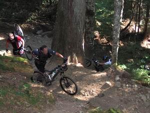
The 18 mile trail offered a surprisingly abrupt wake up call less than 1.5 miles into the ride. The climb to the initial ridge proved daunting as we were all pushing and carrying our bikes up the steep trail. It took nearly an hour to cover the first 2 miles. It would only get worse.


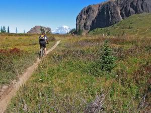
The trail we would follow for the next 16 miles is frequently used by dirt bike riders and, as a result, is very dusty and trench-like. The area hasn't received rain in well over a month and the trail surface was several inches deep of loose sand and silt. It was like pedaling through flour.
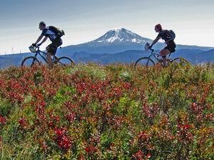
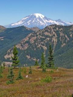
And so we suffered, but the views were worth it. At several points throughout the ride, we were able to see four of the most beautiful volcanoes in the Cascade Mountains range simply by turning around. We headed north throughout most of the day so Mt. Rainier was often in our sights, but we were also flanked by Mt. Adams to the east and Mount St. Helens to the west. And, if you looked closely, you could see Oregon's Mt. Hood way in the distance to the south.
 Without any exaggeration, this was a very difficult ride. Definitely the most difficult I've experienced in terms of the shear amount of effort it took to complete. As if the climbing and trail conditions weren't harsh enough, it was also about 86 degrees and not a cloud in the sky. Despite bringing 140 ounces of fluids with me, I nearly ran out with 7 miles to go.
Aside from the views and the tremendous excercise and comaraderie, the other reason to do this particular route is the downhill. The final 7 miles of the trail plummet 4,000 feet in elevation back down to the trailhead. After taking nearly 4 hours to suffer through the trail's first 8 miles, we were able to knock off the final 7 miles in just over an hour. Why so long to descend 7 miles? Because even with the net elevation loss of 4,000 feet there were still a couple of hike-a-bike sections to get past. But there were several extended portions of singletrack where it was hard to stay below 20 mph, even with the brakes on. Many finished the ride with scoching red brake rotors!

 I was supposed to camp a second night and ride the Plains of Abraham area near Mount St. Helens on Sunday, but I had far too much work to get done and decided that one day of riding was enough this weekend. Those who know me, know that I'm not one to ever say, "no" and that I hate "missing out" on things. But with the upcoming deadline and a trip to British Columbia in the immediate future, skipping a short loop at Mount St. Helens wasn't the end of the world.
1 comment:
You were right. Your walk was much harder than mine. Hahahaha. Thanks for the pictures. Beautiful!!
Post a Comment